| GPS | N33 29.67′ W114 42.60′ |
| Elevation gain | 0-2,600 ft. |
| Season | Year Round: best Oct. -June |
| Terrain | graded dirt, sand |
| Difficulty | easy |
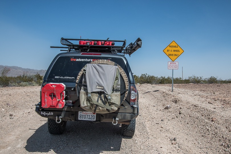
| Required Vehicle | 4WD with high clearance. |
| Time | 4 hours |
| Length | 77.8 miles |
Directions:
Five miles north of Palo Verde on CA 78 and .3 miles north of mile marker 5. Turn west on the paved road marked The Bradshaw Trail and cross over the irrigation channel.
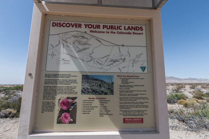
Site Location and Description:
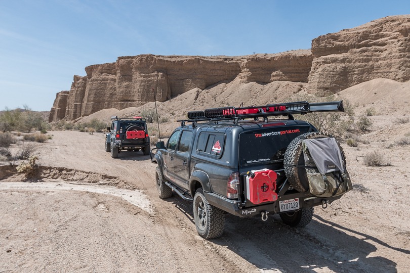
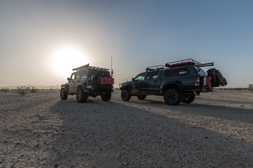
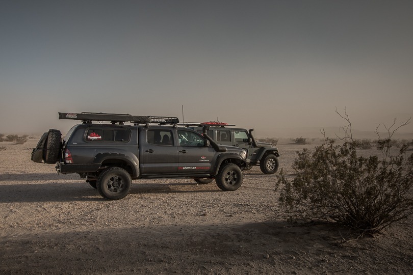
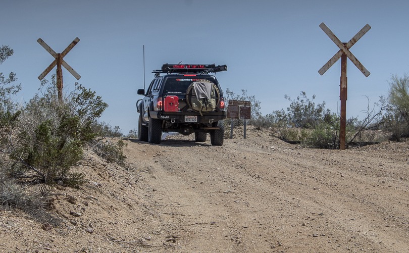
This trail runs from Palo Verde on the Colorado River to the Salton Sea. The majority of the road is graded dirt and sand. The trail travels west from the CA 78 and crosses over Palo Verde Mesa on it’s way through the Mule Mountains. Here you will find a long term visitor area popular with the “Snowbirds” in winter. The Wiley Well Campground is open Sept. 15-April 15 for long and short term camping. West of Wiley Well, the trail is looser and rougher, crossing many shallow washes as it winds along the south side of the Chuckwalla Mountains. These mountains are popular with rock hounds, who have been known to find chalcedony, agate and jasper. A long section of the trail follows the northern section of the Chocolate Mountains. There’s a Military Gunnery Range here and the “keep out” zone is well marked. The trail goes on to cross the Chuckwalla and Orocopia Mountains to the north and the Chocolate mountains to the south. This is the most scenic area of the trail. It goes on to drop into sandy Salt Creek Wash close to the Eagle Mountain Rail Road which served the mines north of the I-10.
History of the Bradshaw Trail:
The Bradshaw Trail came into being after explorer and prospector Pauline Weaver, found gold at La Paz Arizona, close to the Colorado River (now called Ehrenburg). News of gold at La Paz reached the west coast quickly and numerous miners began to scout routes to La Paz to begin prospecting. Getting to the mines in AZ proved cumbersome. One route via ship had the prospectors sailing south around Baja California to the mouth of the Colorado River. From there they boarded a paddlewheeler and steamed upriver to La Paz. The only known overland trails at the time were challenging and took too long for most of the anxious prospectors and merchants.
William Bradshaw, an explorer from Los Angeles, had served under John C. Fremont and was familiar with the new territories. He set about finding a more direct route to the gold mines of La Paz. One thing that Bradshaw had learned when crossing the California deserts was that success came only when water could be reached. Bradshaw knew how to find water in the region; he went to the the local Cahuilla Indian tribe and they guided him across the desert to the Colorado River in a direct eastbound route that had many water holes along the way. Bradshaw returned to Los Angeles and started pushing through a wagon road to connect the Pueblo de Los Angeles to the mines in La Paz. His route followed an existing trail through the San Georgio Portal, then headed southeast toward the rim of the Salton Sea depression. From there, he turned east, climbing up the stony bajada up the wide, sandy wash of Salt Creek that runs close to the Chuckwalla Mountains, and arrived at the Colorado River in Palo Verde Valley.
Here the trail swung north for the last short section alongside the Colorado River (then known as the Grand River) to La Paz. This new wagon trail, although cumbersome and costly to create, cut several days off of the lengthy journey to La Paz. By late 1862, the Colorado Stage and Express Line was running stages on the remote trail. The journey from Los Angeles toLa Paz took five days and cost $40.00. The U.S. mail used the trail en route to Prescott, AZ and Santa Fe, NM.
The Bradshaw trail carried thousands of people to La Paz, which was booming in the 1860’s. The Bradshaw trail crossed by several strikes that wouldn’t be discovered for decades. Bradshaw’s Ferry, which could carry small wagons and a few animals, ran on the south side of La Paz, in the region of today’s 1-10, to transport travelers over the Colorado River. During the 1860’s, La Paz was home to over 5,000 prospectors, but as the ore ran out, people left and La Paz became a ghost town. The Southern Pacific Railroad began running west to Yuma in the late 1870’s. This, along with the bust of La Paz, took away much of the need to travel the Bradshaw Trail. Although travel along the trail diminished greatly, some prospectors heading toward the Chuckwalla and Orocopia Mountains continued to use it. William Bradshaw did not live to see his trail fall into disuse.
Check out more CA Overland, Off-Road trails here and TAP into Adventure!