| GPS | N33 11.156 W 116 04. 971 |
| Elevation | 153 to 305 ft. |
| Season | Year round: best Oct.-May |
| Terrain | Moderate: washes, conditions change due to weather and trail can be difficult to find/follow when obscured by sand. |
| Difficulty | Easy to moderate: packed dirt, washboard, sand, small rocks |
| Required Vehicle | Stock 4×4 |
| Time | Approximately 1 hour |
| Length | 4 miles each way |
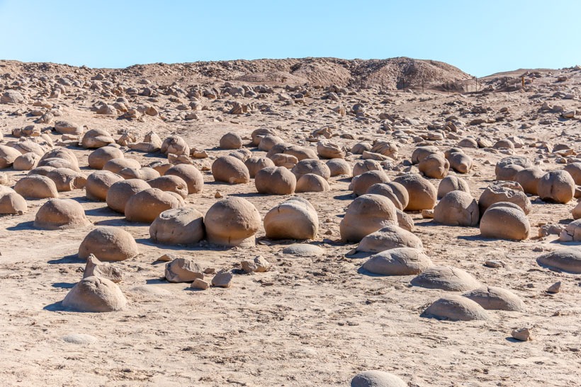
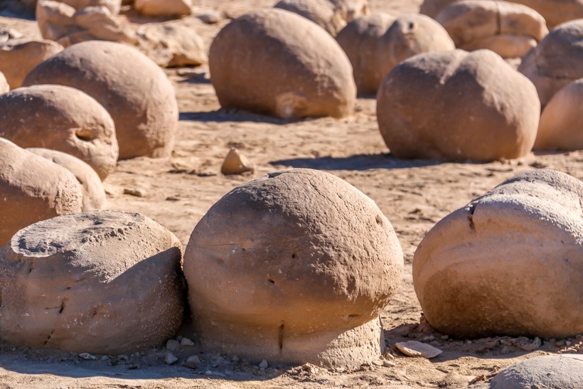
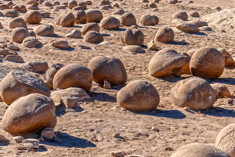
Site Location and Description To reach this area from the south use Shell Reef Expressway to East Bank to Pumpkin Patch Trail. It can also be reached from the north by taking the Cross Over Trail from S-22 to Tule Wash. The Pumpkin patch is about as large as a city block. It is a protected area that is fenced in with an entry area allowing you to walk amongst the amazingly weird rock formations. There is a toilet and lunch area with picnic tables as well.
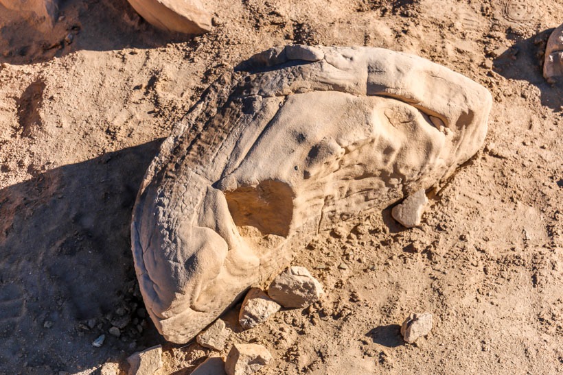
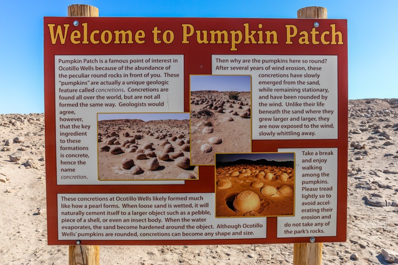
The History of the Pumpkin Patch The Pumpkin Patch is located in the Ocotillo Wells SRVA, just east of the Anza Borrego State Park boundary. These pumpkin shaped rocks are called “concretions” and were formed under the sand by water carrying properties that solidified the surrounding sandstone forming a concrete like substance that dried and then as the sand above it blew away, came to the surface. They usually contain a natural “nucleus” in that the concretion formed around a leaf, piece of shell or possibly a fossil. Sand and weather help shape them. The sandstone is old Diablo sandstone from the Colorado river delta.